Mike Spring
Mike Spring has kindly allowed a copy of his article (originally published at http://02c1289.netsolhost.com/AZORES.HTM) to be displayed below:
Sailing single handed to the Azores and back
E-mail address: mspring810@aol.com
This is some of the photographs and rough log (any log I produce will always be rough!) of the single handed voyage by Mike Spring in his junk rigged Coromandel ‘3M Mariner’.
CONTENTS
THE LOG – Sailing from Falmouth to Ponta Delgarda
THE LOG – Sailing from Ponta Delgarda to Horta
THE LOG – Sailing from Horta to Penzance
MIKE’S PHOTOGRAPHS(200 of them!):
THE BOAT BEING LAUNCHED.
THE BOAT OFF SAO MIGUEL.
ME.
SUNSETS SEA AND SKY.
WHALES
DOLPHINS
THE PIGEON
THE BIRDS
THE MINESWEEPER
THE HELICOPTER
THE NIMROD
THE FRENCH WARSHIP
THE PORTUGESE WARSHIP
APPROACHING SAO MIGUEL
APPROACHING PONTA DELGARDA
ASHORE ON SAO MIGUEL:
PONTA DELGARDA
THE TREES
THE HYDRANGEAS
THE PEOPLE
THE FLOWERS
THE AGRICULTURE
THE HILLS
THE HOT SPRINGS
THE POLICE FORCE
THE PRESS
THE GIRLS
THE SEA STACKS
THE FISHERMEN
THE WILD STRAWBERRIES
THE MINERAL WATER BOTTLING FACTORY.
PORTA DA HORTA
OTHER ISLANDS – PICO
OTHER ISLANDS – SAO JORGE
Why do it?
It all started with a visit to the doctor! Actually the pain specialist Mr John Miles at the Pain Clinic in Liverpool. To cut a long story short, I am a chronic pain sufferer as the result of a spinal injury See Paraplegia. . After I had finished telling him about my problems he started telling me about his problems. Basically, his problems were overcoming peoples pain. The main barrier to this was that not enough was known about pain. With a view to combating this he (and others) had set up the Pain Relief Foundation which was an organization aimed at researching into pain. The problem with this was raising money to pay for research projects and providing a building for the foundation. At that point he asked me if I had any idea about how to do this. My reply was, you need some publicity stunt — perhaps I could sail single handed to the Azores and back. I can’t understand why but this sort of thing is often useful for raising funds. Recently I had sailed single handed around the British Isles and it had attracted some interest from the press and media. In a conversation with a television camera man, who was filming me on my boat, he had told me about how people do stunts like this to raise money for charities. Also I was looking for a new adventure, the Azores seemed just about right. Of course, I said, I couldn’t do this until 1983. It was early 1982 (might have been 1981). At this time 1983 seemed an eternity ahead — so I felt safe.

As you know 1983 has come and gone and as the time for this adventure became more imminent I thought I’d better start doing something about it. I decided that my current boat at that time wasn’t up to the voyage so I had a new one built. I’d long entertained the idea of getting a junk rig. In conversations with fellow sailors I had obtained the impression that a Coribee might be just right for the job. So I decided that a Coramandel built by Newbridge Boats would be just right. When I told my boss at 3M U.K. what I was going to do he put me in touch with the firms public relations man Peter Stallwood for the project. He insisted that I called my new boat 3M Mariner. As well as making many other changes to my plans to optimize the income from the project. I resisted his attempt to postpone it for a year in order to achieve a high powered publicity build up — I couldn’t wait to get started!
Boat about to be launched
This was at Poole in April (I think!) 1983.

from here I sailed to Torquay then on to Falmouth.
After you leave Poole harbour you pass Old Harry (chalk cliffs)

The Log – 1 Falmouth – Ponta Delgarda
imes are BST except for a bit after Ponta Delgarda when they become GMT for a bit.
16/96/83. 11.25 Set sail from Falmouth marina in nasty drizzle and light variable winds.
14:00 1 Mile north of the Manacles the drizzle stopped and the sun came out.
Amongst the wonders of modern technology that people had persuaded me to take on the voyage was a Locator for detecting and determining the bearing of the radar’s of any ships in the vicinity. I experimented with it using it to determine the locations of all the various coastguard scanners along the coast between Falmouth and The Lizard. Its not very good. SEE TECHNICAL NOTES. Just before passing the Manacles I had to cope with another encumbrance of modern technology, that I had been talked into to taking, in the form of a single sideband radio. I had to make my first routine radio communication with my contact in England for the voyage.
Here is a picture of most of my equipment down below.

Here is the view of the cockpit from the same position.

20:00 Rounded the Lizard. The course was set. Great circle course to Ponta Delgarda 247 degrees by the compass. The log was set to zero. A gentle N.E. wind now enabled me to do 3 knots.
Mine sweeper passed me.

22:00 The water is alive with dolphins all going the same way as me.
17/06/83 The dolphins stayed with me until well after dark. Obviously in these waters sleep is out of the question due the density of shipping. The wind is very uncertain. My routine radio contact in the evening informed me that there was a more reliable N.E. wind to the south of me so I changed my course to due South (True).
It dawned a hot sunny day. Still not much wind. I heard two ear splitting bangs just after dawn. Looked round for who was firing at me and not a vessel in sight. The visibility was at least 10-20 miles what could it be?! The answer came when I looked skywardly. There miles up in the sky I saw the faint outline of Concorde jetting off to the USA. It was sonic boom.
Naval helicopters came buzzing around me at one point.

14.57 Observations. Ploneois Consol beacon = 39 dots, Round Island Scilly R.D.F. beacon. This gives a position 49.34 N 5.44 W . Log = 30 miles.
16:00 A whale played alongside the boat for a bit. It might have been a large dolphin. It had a black back, a white tummy, it seemed a bit bigger than the boat and an unusual shaped head. In retrospect it might have been a Right Whale. I failed to get a good photo of it. It would have required a Polaroid filter and I opted for admiring the creature rather than sorting out the camera equipment.
18/06/93 07:00 log = 67 D.R position = 48.54 N 6.38 W . Observations: Ploneois Consol beacon gives 1 dash . Ushant R.D.F. = 120 degrees by the compass. Course = 240 degrees true.
The Pigeon.
13:15 Pigeon landed on boat. It has a ring on its leg. I suppose it must be a racing pigeon. It pecked the deck. I thought perhaps it was trying to ask for food, but it didn’t want to share my Chicken Madras that I had cooked for supper. It wasn’t interested in the drinking water that I offered it, either. It posed for several photographs.


As it grew dark the wind became steady. Still N.E. and only force 4-5. However, a rough sea developed and the pigeon came and cuddled up to me in the cockpit. Previously it had been content with the deck. I was very worried that I might forget about it and sit on it or kick it or something. This is very easy thing to do if, for example, the sail needs urgent attention. Under such circumstances I tend to forget about everything in my struggle to haul my useless body across to the part of the boat that requires attention. Normally I have the boat organized so that it is possible to do this without risking damage or injury. However winged intruders always thwart such organization. I’m reminded of a sail that I had once, from Pembroke to Caernarvon, in which a turtle dove landed on my boat in thick fog off St Davids head. It took a couple of days and was a real epic. The bird stayed with me throughout the voyage and I grew quite attached to it. It was alive five mins before I dropped anchor at the end of the voyage. After I had dropped anchor I found that it was dead. I was very upset. After going through such a desperate struggle for survival on the high seas and then to die when only twenty yards of land seemed so unfair. To make matters worst I began to wonder whether it had keeled over from exposure, exhaustion or hunger or whether I had unknowingly delivered it a blow in my struggle to get the anchor down. I have been haunted by this doubt ever since. This is why I was terrified that history might repeat itself.
19/10/83 10:00 Pigeon flew away. What a relief! Observations: Log = 159 miles. Ploneois Consol beacon gives 27 dots.
The sea is now very rough despite the fact that the wind is no more than a fresh breeze. Still north easterly. The first half of this night was very uncomfortable. I had to hang on tight all the time. No rest. I hope it’s not like this all the way to the Azores! I not sure that I’d be able to cope! Having to pump out the bilges every few hours is also a bit worrying! Many large waves broke right over the boat and when they did water poured through the seal between the glass and the rubber of an escape hatch that was on the forward deck. This was normally waterproof, but the waves landed on the deck with such force that each one seemed to force a few pints of water through the hatch. Unfortunately my sleeping bag was under this hatch. I moved my sleeping bag to the quarter-berth. I’d never have been able to sleep up forward anyway, it’s far to uncomfortable.
20/10/83 Sea eased off as the night progressed and around 02:00 hrs I was able to get 5 hours sleep. This might have been foolish but I had sighted no shipping for some time.
I awoke around 06:00 feeling very refreshed after my first real sleep since I left Falmouth. The sea had calmed right down and a perfect northerly wind was giving the boat good direction and speed. Feelings of optimism and joy came over me. A complete contrast to ten hours before. Now I felt that nothing could stop me from reaching my destination. I sat in the cockpit for some time reveling in the pleasure of my environment. When the boat was on the top of a wave I could see for miles in all directions. Not a sole to be seen. I had the whole ocean to myself. What a wonderful feeling. To cap it all a stunningly beautiful sunrise. I refuse to believe what they say about red sky in the morning!
07:03:41 Solar fix with sextant 20 Degrees 55 Mins. Ploneois Consol beacon gave 11 dots. These give position 47.28′ N 09.51′ W Calculations made in rough book.
Even in good conditions like this the single handed sailor can very rarely rest. Cooking, eating, generating electricity, working out the position, trimming the sail, adjusting the self steering, talking on the radio, washing clothes, hanging them up to dry.
Generating electricity occupies about an hour a day. Probably because I had a duff battery. The main problem here was that I had to keep a good lookout while generating because I would not be able to hear any vessels that might be about to mow me down because of the noise of the generator. I certainly didn’t like to run the generator after dark due to the need to listen out for unlit yachts or unlit warships. I had been warned about a NATO exercise that was taking place in the area which involved warships sailing around without lights. I had the generator well lashed to a cockpit seat but I still didn’t trust it not to fall over when the boat hit a wave awkwardly, consequently I’d keep half an eye on it all the time. It was on the seat rather than the floor of the cockpit to keep it out of the water that filled the cockpit every so often. Ventilation problems made it impossible to run anywhere else, like down below. The odd nasty wave would hit the boat filling the air with salty spray which would conduct electricity causing sparks to flash along the guard rails and the wet ropes that secured the generator. It was always a pleasing moment when I could turn off the generator, disconnect it, untie the lashings and manhandle it back into the locker.
Most of the electricity was used to power the navigation lights at night. Next came the radio, then the satnav, yes, satnav. All other uses were negligible. An electronics firm had leant me a satellite navigator for the voyage. So far I had not managed to get it to work. I had assumed that this was because the initial estimate of my position was wrong so I had not tried very hard. Now that I had a good solar fix and consol fix I was fairly sure of my position and I fed this in and waited for the next satellite to pass overhead. The satellite passed, it analyzed the data, but it still gave a “NO FIX” message. The problem was that I had only received the equipment shortly before setting sail and so had not had time to read the manual really carefully. After re-reading the instructions I found that you had to switch the set on for at least half an hour before the satellite passes over to warm it up. This would normally be no problem on a ship that would have an ample supply of electricity. However with my need to conserve it, after all the trouble it was to generate it in the first place, this was a problem. The equipment gave forecasts of when satellites were due. So I selected a time when a few were due in a short period, switched it on half an hour before the first one and then waited. This way I obtained my first successful satnav fix:-
15:00 Satnav fix 47.28’N 10.09′ W . Log reading = 280 Miles (From Lizard)
Subsequent fixes where obtained by predicting when a satellite was due and switching on forty minutes beforehand. What a waste of valuable power. Which accounts for why I don’t often take satnav fixes.
I’ve never found a satisfactory way of generating electricity while sailing. My previous boat alternated between a windmill and a towed impeller that generated power. However, the navigation lights on the old boat used only 75 percent less power and I had no electronic equipment. Even then, the windmill created windage, got in the way, eat up any stray ropes and the whole system was very messy and caused no end of problems.
21/06/83 Calm sea, light northerly wind, overcast sky and fairly warm. Feeling fine, rested, appetite returned.
16:04 Satnav fix 46.46’N 11.51’W Log = 345.
The lack of wind is becoming a problem. There is a large anticyclone to the north west, according to a man on the radio, so I am trying a more southerly course in an attempt to pick up more wind. Compass Course = 220 Degrees true.
22/06/83 06:15 log = 380. Wind Moderate NNW Course=240 degrees true
14:00 Log = 412.
The French warship


French naval vessel passed close by and the skipper talked on the VHF radio. Said that the weather should stay good for 3 days and gave the position as
45 57.5’N 12 55.5′ W
He asked whether I wanted anything. “Nothing” I replied. Any other reply would have been a poor reflection on my planning and preparation. Afterwards I couldn’t help wondering what would happened if I’d have said that I was fresh out of champagne. I’m told that French naval vessels are manned by very hospitable people.
16:30 The log seems to have gone back to zero. I must have brushed against the reset button. For the purposes of calculating my D.R. position I’ll assume that it read 420 miles when this happened.
23/6/83 11:00 Observations: Log reading 72 miles, Ploneois Consol beacon gives 54 dashes. The latter gives a position further south than my D.R.position.
14.00 Estimated position 14.20′ N 44.57′ W. Still can’t get the satnav to work. Perhaps the estimated position is too far out again. The sun is trying to break through.
16.07.36 Solar fix with sextant = 56 degrees 50 mins. (Index error = 32′) Ploneois Consol beacon gives 51 dots. These observations give a position of 44.32’N 14.39’W This is still further south than my D.R.position. Perhaps I should allow for the Portugal current taking me south at half a knot from now on. This, however, would not have been enough to account for the discrepancy.
18.15 Satnav fix – I’ve got it to work! 44.45’N 14.44’W.
Log reading 101 miles.
Before setting off I had marked consol grid lines on my chart. I had written a program on my home computer to calculate their positions. I’ve just done some checks to see if I’ve marked them correctly and they seem O.K. I thought an error in these might account for the discrepancies.
Course now 242 degrees.
24/06/83 Wind died away completely. Calm night. Had a good sleep but not much progress. Egg and Beans for breakfast – its what I fancied. I’ll have the remains of last nights curry tonight. Perhaps I should cool it down a bit by adding a tin of tomatoes.
14:00 Log = 130 miles . D.R position = 44.45′ N 15.25′ W.
Poor radio contact with England. Light NNE Wind gradually reappearing.
20.05 Passed slowly within a few feet of a ketch flying the New-Zealand flag on a reciprocal course. We were both slow that I was able to have a conversation with the crew, about six of them were lazing about on the deck. They were bound from Ponta Delgarda to Falmouth. I said that I was bound from Falmouth to Ponta Delgarda but had come 100 mile south of the direct course in search of wind. They said that they had been forced on to a southerly track by the northerly winds. Also they had radio contact with people 100 miles to the north where is is currently dead calm. I took a photograph of their boat as it disappeared astern.
An Artic Tern, I think – glides along with the boat all day. I think it uses an upcurrent produced by the sail, as lift.

20.30 A small bird. It keeps darting about a bit like a swallow. Fluttering around the boat. Black with a white stripe across its body just in front of its tail. I later discovered that this was a storm petrel. The white stripe on the wings is not visible (Until this photo was developed) because it flutters so quickly.

25/06/83 Showery day. Wind light NNE. Fresh in showers.
9.30 Sighted a whale with a long black back and a short stubby dorsal fin.
Made as series of solar fixes with the sextant:
Time, Altitude Of Sun, Log reading.
10.31.12 , 41.57′ , 187
11.09.24 , 48.13′ , 187
16.34.34 , 54.23.6′ , 195
18.48.56 , 30.26′ , 201
These indicate a position at 16:34 hrs of 43.15’N 16.08’W . I’m obviously still being set in a southerly direction. Compass looks O.K. It must be that the Portugal current is a bit stronger than tabulated. One should not expect nature to be too consistent. My compass course to P.D. should be 263 degrees but I’ll steer 270 to compensate for the current. Its always best to over compensate for a current to start with and make up for it later in case you get becalmed.
19:00 No more showers. Fairly sunny. Wind now freshening.
26/06/83 Not much wind, but a nasty swell from the north makes life hard. Took photographs a great big waves through the starboard porthole while down below.


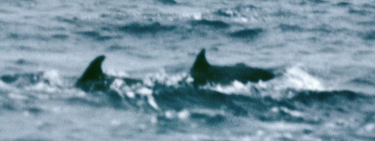
The dolphins
27/06/83. Very rough night. Near gale force northerly winds. Making good progress. As the day dawned hundreds of dolphins were escorting the boat as it raced along with the waves at about eight knots. They gave a display of jumping diving leaping often three at a time in formation. I took many photographs of them but could never get it quite right. They move so fast and they never tell me what they are about to do. The photos are either going to be blurred of out of focus or both.


I’ll give up trying to photograph them and just sit back and enjoy the display.
As the day progressed the wind moderated and the sea calmed. Progress became easy and pleasant.


29/06/93 Fine day with a gentle wind. Slow but steady progress. Before I set sail an aunt gave me a book of poetry and made me promise to read poetry aloud to the sea at some point in my voyage. Now was the time. I don’t know why I felt so self conscious there was no one around for many miles. I had seen no other vessels for several days so no one could possibly see me doing such a mad thing. Much to my surprise I found myself reading in a Scottish accent. Very strange because I normally cannot mimic one if I try. “Is there anybody there said the traveler”…etc. The tone in my voice grew more and more irate and acquired a trace of contempt for the person that was not there. It seems as if one can express more of one feelings by subtle changes in tone, when speaking in a Scottish accent.
There are many seabirds around. I saw something that looked like a polythene bag in the sea. I think that it is part of a jellyfish, a Portuguese man of war perhaps. Loads of seaweed in the sea. The day started off Showery but the showers died away and the sun became strong.
30/06/83 Wind direction keeps changing causing jibes. It us usually Northerly or Easterly.
2/7/83 02:00 Sighted lights in the distance to the South West. These must be the lights of the village of Norde Este on the Isle of Sao Miguel. I’m slightly worried as to why I can see these but not the lighthouse on the east end of the island. I assume that the answer to this question is that this village is high up the mountain side whereas the lighthouse is right down at sea level.
04:00 Sighted the light of the lighthouse at the east end of Sao Miguel — The Pta Do Arnel light to be precise.
Approaching Sao Miguel
08:00 Sighted land.
11:00 Rounded Pta Do Faial. The south coast of Sao Miguel consisted of very beautiful mountains, apparently covered in trees, with agriculture on terraces. Very green. Couldn’t stop taking photographs. Escorted by dolphins getting up to their usual antics.


Villa Franco Da Campo.


Approaching Ponta Delgarda


21:00 Arrived Ponta Delgarda. I called up the harbour authorities on the VHF and they insisted that I had a pilot for entering the harbour. I tried to refuse this pointing out how small my vessel was. I was terrified that they were going to charge me a vast fortune for this privilege. However fortunately there was no charge for this service and it is absolutely compulsory according to their radio operator. The conversation brought home to me how limited my Portuguese was. I had a book and tape to teach me the language The intention was to learn it during all the free time on the voyage. Alas there is not very much free time when single handed sailing, consequently I did not acquire much proficiency at the language.
============================
PONTA DELGARDA


The fishermen.


The law!

The Portugese Navy


The trees


The Hydrangeas


The hot springs


The local people use the hot springs to cook their food.

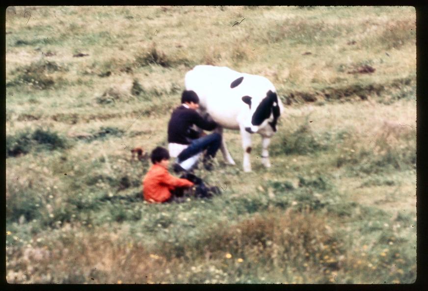
The people
They where digging something out of the ground. What was it?

It was their Sunday lunch! The ground was so hot with the volcanic activity this was how they cooked.

They invited me to share it.

The Mineral water bottling factory.

The flowers


Up in the hills


These kind people drove me around the island showing me the sights.

They took this photo of me.


They whitwash the cliffs at the side of the road to prevent rock falls.


The sea stacks


The agriculture
The cattle.

This ornate white construction is where the cattle drink


They milk the cows in the fields.

Then transport then in churns, on horseback.


On the south side of the island they grow all sorts of things. Sweet corn, pineapples etc…


Wild strawberry


The press
Homer Sykes (photographer) and Peter Martin (journalist)

Here are some of the pictures Homer Sykes took of me and my boat.


BOAT OFF SAO MIGUEL


The girls


====================================
THE LOG – 2 PONTA DELGARDA – HORTA
21/07/83 13:00 Departed from Ponta Delgarda. Warm becoming overcast. NNW Wind. Course to St Mateus on Pico 304 Mag.
Progress laboriously slow being close to the wind.
22/07/83 Slept from 01:00 to 07:00! With the wind vane self steering gear set close to the wind on a starboard tack. Unfortunately the wind backed during the night and on awakening the course was 203 Mag. On account of the wind direction I’ve decided to make for Terciera so I’ll go onto a port tack. Log = 26.
Rough seas and overcast skies today.
In the evening the wind veered again so I resumed my course to Horta. Generally a light wind, occasionally freshening, but the confused and short steep waves slow the boat to 1-2 knots and make it very uncomfortable.
23/07/83 Not very good progress but the state of the sea is steadily improving and I had a sunny evening. Good spaghetti nosh.
Managed to make radio contact with Rudi Weber (G4FTO) in Falmouth Englend.
19:30 Log = 97.
24/07/83 12:00 Pico sighted. It must be 20 miles to the north. The sea has turned nasty again. There seems to be a bad swell but no wind. The swell is coming directly from Pico only 20 miles away so I imagine that there is a strong northerly wind to the north of me.

16:00 Tried using the engine but it seems to have jammed. Gusting northerly wind has now appeared.
20:00 Wind speed keeps on gusting up to 30 knots and then going completely calm. It goes from one extreme to the other in a second or two. Only 4 miles south of St Mateus point on Pico.
The night was spent attempting to tack up the sound between Pico and Fial against both wind and current. I had to charge the batteries to keep the nav lights going as it was a busy channel. Waves kept breaking over the generator causing many sparks. Many of the boats passing me do not have proper navigation lights but some have very pretty Christmas trees! I’m told that this is typical of Portuguese fishing boats. As it dawned I found a way of cheating the current by tacking up close to the rocks outside Horta Harbour wall and eventually getting round into the harbour. Without an engine it was slightly difficult to dock almost being overcome by weather helm preventing a jibe. This often happens when reefed. I managed to jibe just in time to avert disaster and docked alongside a yacht alongside the main harbour wall.
===========================
Porta Da Horta


The Great Wall of Horta — It is customary to write the name of your boat here.


Tuna fish factory.

Whale vertibra.

Moving house – Azores style.


While in Horta I could not get the engine repaired so had to purchase a new one. A Volvo Archemedies 6 HP the only engine that I could find that ran on petrol. Most of them use paraffin in Horta. I stocked up with food and water including a large salt cod and a gift of vegetables from the local people. I also managed to swap tins of M & S Chunky Chicken and M & S Chunky Steak for tins of squid and tins of smoked oysters. Seagull offered to send me a new part for the engine and the Portuguese navy offered the use of their workshop to repair it. This was abroad their frigate which had just sailed into Horta. Unfortunately I was anxious to get home before the Autumn gales descended upon England so I could not avail myself of these offers. Horta was an interesting place to walk around taking photographs. Working windmills were on the hills overlooking the town. Unfortunately there was not time to make a tour of the island or go over to Pico, but I’ll be back some day.
=================================
THE LOG – 3 HORTA – PENZANCE
02/08/83 11:15 Departed Horta. Course 60 Mag. Heading towards the west end of Sao Jorge which is just visible through the haze. 50% Cloud and a moderate South wind.
Looking back at Horta,

14:00 Wind changed to light S.E.
16:56 Due West of Sao Jorge log = 16.8. The west point of this island has spectacular cliffs which I photographed. However they probably wont come out very well as it is becoming awfully hazy.

22:14 Becalmed log = 22.4
03/08/83 03:00 Light southerly wind appeared. Lots of fishing vessels around. The island of Gratciosa appeared as it got light.

10:00 log=42 Gratciosa North end bears 120 Mag. Course now 50 Mag.
19:03 log = 59 Course now 30 Mag.
04/08/83 00:00 Log = 72 Course now 60 Mag
02:08 Log = 77 Course now 15 Mag. The problem is a tendency to jibe in the moderate variable Southerly wind. Warm overcast night. Lightening is visible to the west.
04:30 Log = 84 Course now 30 Mag
14:00 Log = 105 Course now 50 Mag A shower followed by a moderate westerly. Sunshine with cirrus clouds. Barometer = 1060 steady. I seem to have a cold and my pressure sores ( 1 on each side now) are looking as if they might be infected. I think that I’ll take a course of antibiotics and lots of vitamin C.
5/8/83 Very steady SW wind, clear blue sky, calmer sea enabling me to keep a steadier course. 40 Mag.
09:00 Ship Herculanian (or something like that) came close and gave me my position on Ch 16 (41.15 N 16.30 W) I didn’t ask for it. I merely asked them to report my position to the U.K coastguard because I couldn’t get my SSB radio to work. Log = 151.

16.25 Satnav position 41.13 N 27.22 W Log=167. This is not consistent with the position given me by Herculanian but more consistent with my DR position. See chart 4013.
06/08/83 07:30 Woke up to find the boat had jibed. Fitted a jibe prevention device to the boom. Log=190.
09:00 log=195 Satnav Position 41 39 N 27 11 W. Managed to get my SSB radio to work by abandoning my high tech aerial and using the mast, together with a bit of tuning. I shall now tabulate positions before I call England. Course = 50 Mag = 35 True. Sec lat = 1.333 (Beautifully round figure for estimating!)
Time, Log(-195, Lat, Long
12:00, 200(5), 41.43, 27.07
13:00, 204(9), 41.46, 27.04
18:00, 214(19), 41.55, 26.56
07/08/83 Badly becalmed all night and into the morning. Very smooth sea. Ice shower cirrus in streaks (of the sort that usually indicate high winds) passed over in a belt from the S.E.
11:00 Something big in the water is following me. (RETROSPECTIVE NOTE :- It was obviously a shark – I’ve since seen sharks and that is exactly what they look like.)
11:50 Log= 226 Satnav Fix 42.07 N 26.58 W
18:00 Calculations for radio contact.
4 Miles on 42.11 N 26.58 W
6 Miles on 42.13 N 26.58 W
In the Azores I purchased lots of green banannas (Plantains if you wish to be precise — according to an expert!) and pineapples. The idea being to ripen them by placing them in the sun. After doing this for a few days I noticed that the banannas that were wrapped up and stored in the bilges were ripening and those that I had placed in the sun were staying green. So I reversed this process i.e. to ripen them I wrapped them up and stored them in the bilges. Those That I wanted to save for later I placed on the deck in the sun. This worked perfectly.

08/08/83 02:00 Log=232 Wind (At last) Moderate northerly.
Course now = 90 Mag = 74 True.
10:42 Course now 90 True. Satnav fix (log=262)
42.22 N 26.08 W
Estimated positions for radio contact.
Log Time North West
12:00 42.22 26.05
13:00 42.22 26.02
276 18:00 42.22 25.54
Dull overcast sky, feeling fed up.
Not much progress. On a port tack I head due east towards Spain and Portugal.
I’m trying to avoid this as they are having bad weather. On the other tack I head N.W. which is towards better weather but is not getting me nearer home and going straight into the swell. This is so nasty that I can only do 1 knot on either tack. Better weather in the evening.
Sunsets and skies
Throughout this voyage there were many spectacular clouds and skies particularly around sunset. Here are some of them.


09/08/83
10:30 Estimated position 42.22 N 25.06 W.
10:40 Log=313 Satnav Fix 42.34 N 25.03 W.
Wind backed. New course 75 Mag = 60 True.
Estimated positions for radio contact.
13:00 Log 317 Dlat=2 Lat=42.36N Dep=3.5 Dlong=4.6 Long=24.57
Pos = 42.36 N 24.57 W
Nasty mountains of cumulus in distance (to the N.E.)
18:00 Log=330 Estimated position = 17 miles from 42.34 25.03 on course=60 True
Dlat=8.5 Dep=14.7 Dlong=20 Position = 42.42 N 24.43 W.
10/08/83 02:00 Nasty night, reefed sail, got soaked.
07:40 Log=359 Wind veered to NE by E. New course 345 Mag = 330 True (S tack) 46 miles from last sat fix.
Dlat = 2×11.5 = 23 Lat = 42.57
Dep = 19.9×2 = 40 approx Dlong=53 long=24.10
Position at change of course=42.57 N 24.10 W
11.07 Log=367 Satnav fix 42.59 N 24.19 W.
New course 0 Mag = 345 True. (wind veered)
13:00 log=373 Estimated position 42.59 N 24.19 W. Strong NE wind.
18:00 Lighter wind (moderate) but nasty swell coming from north. Log=384 Estimated position 17 miles on gives Dlat 16.3 = 16 approx. Dep=4.7 Dlong=5.9 = 6 approx. Position = 43.09 N 24.25 W.
11/08/83 Sea calmer, wind steadier (moderate).
10:21 Log=426. Satnav fix 43.48 N 25.08 W.
11:00 Ship Andre Santos sighted. Chatted on Ch 16. Rusty old ship with people lazing about all over the deck. Asked if I needed anything, replied no. They said that they are bound for Terra Nova. New course 90 True.
13:40 Estimated position 43.48N 25.04 W
16:00 Log=432 Gone about. New course 340 True
Estimated position 43.52N 25.00 W.
12/08/83 07:44 Log=444 Going about again. New Course 90 Mag = 75 True
Approximate position 44.00 N 25.00 W.
Showery. Wind keeps changing direction and strength and I keep on tacking to take advantage of it. Assuming that I spend half the time heading due North and the other half due East.
13:00 Becalmed. Approximate position 44.03 N 24.56 W .
13:30 North Wind. Course = 90 True.
18:00 Log=459 Approximate position = 44.03 N 24.48 W
13/08/83 08:00 Log=488 Satnav Fix 44.19 N 24.45 W. Course = 45 True. Mostly becalmed, hot and sunny. (calm sea) Occasional Light NW wind.
18:00 log=494 Estimated position:
Distance = 6 miles Dlat=Dep=4.2 Dlong=5.6=6 approx.
Position = 44.23 N 24.39 W.
Wind N.W. Lizard = 857 miles away on a course of 53 True=67 Mag.
The whales
19:30 3 Large whales sighted. 2 of them came within a few feet of the boat. Good photos but the film snapped on rewinding. (Hump backs?) Now a large whale about a mile or two to the east has started to do the most amazing gymnastics. Jumping, waving its tail in the air and waving its body in the air vertically. What a pity I can’t photo it because of the snapped film in the camera. I don’t wish to waste this film as these photos could be the best ones of the voyage. I made a dark room in the quarter berth and removed the film, after dark. I’m not sure how good this is as light shines through the fibre glass during the day. (RETROSPECTIVE NOTE :- The home made dark room worked. The whale photos came out)


Gentle Westerly breeze.
14/08/83 08:00 Moderate Westerly, gentle sea, 50% Cloud.
Estimated position. Time=10:00 Log=532 Dist=38 Dlat/2=7.4 Dlat=15 Dep/2=17.5
Dep=15 Dlong/1.4 = 21 Position=44.38 N 24.18 W .
11.06 Log=537. Satnav Fix
44.47 N 23.55 W
Estimated Positions:
Time, Log, d, Dlat, Dep, Dlong, Position
12:00, 539, 2, 1.1, 1.6, 2, 44.48 N 23.53 W.
13.00, 542, 4, 2.2, 3.2, 4, 44.49 N 23.51 W.
Course = 80 True.
18:00 Log=560 D=18 Dlat=3.1 Dep=17.7 Dlong=25.
Approx Position= 44.52 W 23.26 N.
Bad swell from S.W. Moderate Westerly. In order to avoid jibing in this combination of wind, swell and temperamental self steering I must head 90 True. Speed = 5 Knots ( 4 Knots generally but 6-8 on the front end of large waves ) Very overcast.
20:30 Log=572. Clag cleared from the west. Beautiful red sunset. Wind suddenly changed to light N.W. New Course= 50 True. Course very variable on account of swell from S.W. (Gradually decreasing)
23:00 Course 10 True. 1 Knot. Light wind, rough sea, boat hardly moving, desperate!
15/08/83 05:58 Log=591.
Awoke after 4 hours of deep sleep to find boat bombing along in a northerly direction. The wind had changed to westerly.
New course = 15 True.
Spotted a large tanker far to the north.
08:30 Log = 601 New Course = 65 True
Overcast, moderate S.W. wind, slight sea.
09:00 Log=601 Approximate positions:
Log, Course, D, Dlat, dep
572, 80, 12, 2.1, 11.8
591, 10, 19, 18.7, 3.3
601, 15, 10, 9.7, 2.6
604, 65, 3, 1.3, 2.7
Total 30.8 20.4 X 1.4 = 28
Position= 45.23 N 22.59 W .
12.11 Wind veered, new tack. Course=25 True.
12.12 Log=617 Satnav fix 45.31 N 22.38 W
16:32 Log=638 Satnav Fix 45.38 N 22.21 W
16/08/83 Very nasty night. South Easterly gale.
09:42 Satnav fix 46.25 N 21.47 W.
Course= 35 True Speed = 2 Knots.
Wind now moderated.
The Nimrod
14:00 Father Christmas (Yes, I know it’s the wrong time of the year!)visited me in his Nimrod from R.A.F. St Mawgan. He dropped two bags of goodies and chatted on the radio for a while.


Light N.E. Wind nasty confused swell. Not steep but large and nasty.
Course = 105 True.
17/08/83. Wind gradually backed until by 08:00 I am able to set a course directly to Falmouth. (Course = 65 True). Still nasty swell. Coming more from North now.
12:04 Log=731 Satnav fix 46.35 N 21.29 W.
18:00 Log=751 Estimated Position. Dep=18.1 Dlat=8.5=8 Approx. Sec Lat=1.5 approx Dlong=27. Position = 46.43 N 21.02 W.
17/08/83 08:30 Log=801 Estimated Position.
D=70 Dep=63.4 Dlong=95 Dlat=30 Position=47.05 N 19.54 W.
11:50 Log=814 Satnav Fix 46.55N 19.57 W. (613 Miles to go!)
18:00 Log=836 Estimated Position:
D=22 Dlat=20 Dep=9.3 Dlong=13.9=14 Approx. Position=- 47.15 N 19.43 W.
Wind still NNW and a nasty swell but the swell is improving, the wind is dropping, more sunshine as well.
18/08/83 8.00 Wind light, sea slight sun shining.
Log=881 Approx position:
D=67 Dlat=3.0 Dep=6.3 Dlong=91 Position= 47.23 N 18.56 W.
Two ships visible, 1 to the north and 1 to the south. Each sent a helicopter to look at me. The first was a small U.S. Navy one, the other was unmarked.

11:20 log=884 Satnav Fix 47.33 N 18.03 W . (527 Miles to go)
LOG STOPPED WORKING. Wind gradually died away.
19/08/83 There have been lots of oil tankers heading due east or due west. I must be on a route. The wind has become very variable over night, first north then from the south. It ended up NE. Then at 8.30 went NNE. Generally overcast but a nice sunshine.
7.28 Satnav Fix 47 48 N 17.28 W (500 miles to go)
14:00 Good NW wind. Now doing 4 knots, I think, but no log!
15.56 Satnav Fix 47.54 N 17.03 W (482 miles to go) Course = 68 True = 81 Mag.
21/08/83 Wind and sea gradually died down over night. Very slight sea and NNW wind. In the morning sunshine and showers gradually dyeing away.
8.46 Satnav Fix 48.04 N 15.49 W (436 Miles to go)
13:00 Estimated position assuming 3 knots on a course of 65 True:
Dist=14 Dep=12.7 Dlat=5.9 Dlong=19 Position=48.10 N 15.21 W.
14.54 Satnav Fix 48.10N 15.21 W. Thus we have gone 25 miles in 6 hours = 4 knots approx.
18:00 Estimated position 12 miles further on:
Dlat=5.1 Dep=10.9 Dlong=16 Position=48.15 N 15.05 W.
22/08/83 Wind died to about 8 Knots and backed to WNW
10:30 Satnav Fix 48.29 N (355 Miles to go) Speed = 2.75 Knots
16.02 Satnav Fix 48.33 N 13.40 W. (341) Speed = 2.5 Knots
18:00 Estimated position (5 miles further on)
Dlat=2.1 Dep=4.5 Dlong=6.75(=7 approx) Position=48.37 N 13.33 W.
23/08/83 Wind freshened overnight. Still N.W. Bit of a swell, overcast, making good progress.
8:50 satnav Fix 48.54 N 12.30 W 290 miles to go. I have been averaging 3 Knots. Course to pass south of separation scheme = 76 True = 87 Mag.
13:00 estimated position 12 miles further on: Dlat=2.9 Dep=11.6 Dlong=18 Position=48.57 N 12.12 W.
15:14 Satnav fix 49.01 N 11.55 W. 266 miles to go. Have been averaging 4 knots.
18:00 Estimated position 14 miles further on.
Dlat=5.9 Dep=12.7 Dlong=19 Position=49.07 N 11.36 W.
24/08/83 Rough night, Overcast, drizzle Wind N.W. 6.
9.44 Satnav Fix 48.56 N 10.09 W. 201 to go. 3.6 Knots.
Courses (Magnetic): 80 To clear traffic separation scheme.
70 For Lizard.
Actual course is 90 True – due to NNE wind.
13:00 Estimated position 8 miles further on is 48.56 N 09.54 W.
15:32 Satnav fix 48.56 N 09.48 W. 188 to go, 2 knots.
Course for Lizard = 70 True = 80 Mag.
18:00 Estimated position= 48.56 N 09.43 W.
25/11/83 Wind and sea died down. Wind now NNE 3 forcing an easterly course. Slight fog, visibility half a mile.
A large wave broke over the boat in the night and came down below swamping the electronic gear. I had just opened the hatch at the time!
THE SATNAV NO LONGER WORKS. The radio was also soaked but seems to work now. Speed approx 2 knots.
11:58:02 Solar fix 51.48
Estimated position 48.56 N 8.13 W
Time, Sun GHA, Declination
10:00, 329.26.9, 10.53
+1:50 29.30.0
+0.02 .5
Total 359.07.4
Longitude 8.13
LHA 350.54 = 9.06 east of estimated position.
Latitude – Suns declination = 48.56 – 10.53 = 38.03
Log Natural
Ver LHA(9.06) 8.0999
cos lat(48.56) 9.8175
cos dec(10.53) 9.9921
Total 7.9095 .0081
Lat-Dec(38.03) .2125
Total .2206
Therefore calculated zenith distance of sun = 38.47
Therefore calculated altitude of sun = 51.13.
Observed altitude = 51.48
Index error = .34
Total 51.14
Correction .13
Total 51.27
Therefore the sun is 14 Mins higher than calculated.
Therefore (as it is almost due south) my actual latitude is 14 miles south of that estimated. I.E. 48.42 degrees north.
Combining this (on the chart) with an RDF fix for Scilly (Round Island) of 233 degrees (one reading was 232 and one was 234) gives a position 48.42 N 08.35 W.
13:30 More RDF fixes on the Scillies 54,60,62,58,62,64,58,59,62.
Average is 60 degrees. Ploneis Consol Station gives 58 dashes. What a big cocked hat! I think that the astro fix must be out because of the poor visibility (About half a mile) this makes the horizon low and thus the sun high. Course to steer = 62 True = 71 magnetic. Alas the wind dictates a more easterly course. 80 True at the moment.
26/08/83 Wind still between N and NE dictating course.
8.15 RDF Fixes on Round Island (magnetic) 34,34,32,40,40,30,38,42 Average = 36 degrees. This gives 27 degrees true. Ploneis gives 19 dots.
Plotting these on the chart gives a position of 48.38 N 07.03 W and a course for the Lizard of 42 True = 51 Magnetic (110 miles to go ). Actual course at the moment is 70 true.
Estimated Positions:
Time, Distance Dlat, Dep, Dlong Lat, Long
11:00, 5, 2, 4.7, 7, 48.40, 6.56
13:00, 9, 3.1, 8.5, 13, 48.41, 6.50
12:50 Passing ship called Antares gave me a position. 48.39 N 07.14 W.
16.50 I’m now close enough to pick up the Shipping Forecast:
Plymouth NE 3 or 4
Sole N 3 or 4
Scillies N 2
27/08/93 Slight improvement in visibility.
Ploneis gives 40 dashes. Estimated position 48.45N 06.00 W
Solar Fixes: (Declination of sun = 10.14, Lat-Dec=48.45-10.14=38.31)
Time 09:26:53, 09:29:29
Observed Altitude of Sun 36.42, 36.04
GHA of sun at 8 AM 299.35.0, 299.35.0
+ Minutes correction 21.30.0, 22.15.0
+ Seconds correction 13.3, 7.3
Total 321.18, 321.57
East 38.42, 38.03
LHA 44.42, 44.03
Log Ver LHA 9.4612, 9.4491
Log cos lat 9.8191, 9.8191
Log cos dec 9.9930, 9.9930
Total 9.2733, 9.2612
Antilog 0.1876, 0.1825
Ver(Lat-Dec(38.31)) .2176, .2176
Total .4052, .4001
Zenith Distance 53.30, 53.08
Calculated altitude of sun 36.30, 36.52 ***
Observed altitude of sun 36.42, 37.04
Index error .34, .34
Total 36.08, 36.30
Correction .13, .13
Total 36.21, 36.43 ***
Observed – Calculated -.09, -.09
*************************************
RETROSPECTIVE NOTE At this point I had a slight mental block probably due to tiredness. The above calculations indicate that the sun is 9 mins lower in the sky than calculated from my D.R. position. Thus I must be 9 miles further from the sun I.E. North West of my D.R. Position. This is a good position. However for some reason I reversed this and regarded the sun as being higher giving me a calculated position line 18 miles south east of where it should have been. I combined the position line that this gave me with the fix on Ploneis and erroneously concluded that I was in the middle of the Ushant Traffic separation scheme. I didn’t discover this for some time (at least a day) and it accounts for the crazy and very worrying anomalies in my navigational observations over the next day or so and the resultant errors in my positions calculated.
*************************************
Both observations indicate 9 miles nearer sun.
A Value = 1.15 B Value = .306 A+B=1.456 giving a bearing of the sun (Azimuth) of 47 Degrees.
When this position line is plotted on the chart together with the fix of Ploneis (40 dashes) gives a position of 48.36 N 05.40 W.
OOPS! I’M IN THE MIDDLE OF THE USHANT TRAFFIC SEPARATION SCHEME. I’ll have to head NNE using the engine.
Cool and sunny. Visibility is good. I discussed the position with a radio
contact who said that if I was where I thought I was I should be able to see many ships. I scanned the distant horizon and couldn’t see any.
12:18:00 Another solar fix 51.39 degrees. DR pos = 48.36 N 05.40 W
(Declination of sun = 10.10, Lat-Dec=48.36-10.10=38.26)
Time 12:18:00
Observed Altitude of Sun 51.39
GHA of sun at 12.00 359.35.7
+ Minutes correction 30.0
Total 360.06 = 00.06
West 00.06
LHA 05.34 EAST
Log Ver LHA 7.6736
Log cos lat 9.8204
Log cos dec 9.9931
Total 7.4871
Antilog 0.0031
Ver(Lat-Dec(38.26)) .2167
Total .2198
Zenith Distance 38.43
Calculated altitude of sun 51.17 ***
Observed altitude of sun 51.39
Index error .34
Total 51.05
Correction .14
Total 51.19 ***
Observed – Calculated .02
The sun is observed to be 2 mins higher than calculated. Therefore my
latitude is 2 mins less than DR pos.
14:23:28 Its getting sunnier. Another Solar fix 44.24 DR POS 48.42 N 05.40 W
(Declination of sun = 10.10, Lat-Dec=48.42-10.08=38.34)
Time 14:23:28
Observed Altitude of Sun 44.24
GHA of sun at 14.00 29.36.0
+ Minutes correction 45.0
+ Seconds correction 7.0
Total 35.28
Lat 5.40
LHA 29.48
Log Ver LHA 9.1213
Log cos lat 9.8195
Log cos dec 9.9932
Total 8.9340
Antilog 0.0859
Ver(Lat-Dec(38.26)) .2181
Total .3040
Zenith Distance 45.54
Calculated altitude of sun 44.06 ***
Observed altitude of sun 44.24
Index error .34
Total 43.50
Correction .13
Total 44.03 ***
Observed – Calculated .02
The sun is observed to be 3 mins lower than calculated. Therefore my latitude is 3 mins more than DR pos but I’ll work out the exact Azimuth to be more precise: A=1.12 B=.317 A+B=2.34 Thus the sun should be bearing 32 degrees. We seem to have regained the couple of miles that we lost in the previous fix. Perhaps the fix was out. I’ll assume a speed of 4 knots in a northerly direction after another 2 hours will place us 8 + 2 miles north of the last D.R. Position which will give us a position of 48.52 N 05.40 W.
A couple more solar fixes:
Solar Fixes: (Declination of sun = 9.46, Lat-Dec=48.52-9.46=39.06)
Time 17:41:27 17:44:13
Observed Altitude of Sun 15.11 14.35
GHA of sun at 6 PM 59.40.8 59.40.8
+ Minutes correction 25.15.0 26.00.0
+ Seconds correction 6.8 3.3
Total 85.2.6 85.44.1
LONG 5.40 5.40
LHA 79.13 80.04
Log Ver LHA 9.9100 9.9178
Log cos lat 9.9937 9.9937
Log cos dec 9.8181 9.8181
Total 9.7218 9.7296
Antilog 0.5269 0.5365
Ver(Lat-Dec(39.06)) .2240 .2240
Total .7509 .7605
Zenith Distance 75.35 76.08
Calculated altitude of sun 14.25 13.52 ***
Observed altitude of sun 15.11 14.35
Index error .34 .34
Total 14.37 14.01
Correction .11 .11
Total 14.48 14.12 ***
Observed – Calculated .23 -.20 Strange but consistent! We must be 20 (or 23) miles to the west. I’ll do the azimuth thing. A=.196 B=.161 A+B=.357 Az=256.8 = bearing of sun. This is all very worrying, I’ll take some RDF fixes at 19.40 GMT.
Scilly 350 + or – 5 Mag = 342 True
Lizard 43 + or – 5 Mag = 35 True
Ploneis gives 43 dots
They give a pretty good cocked hat on the chart at about 49.27 N 05.58 W
I’m happier now. The last solar fix is more consistent with this position. The fact that I was 20 miles further west than I thought I was might explain the anomalies in the previous observations.
RETROSPECTIVE NOTE At this point I worked backwards and discovered the error that I had made with my 25/11/83 11:58:02 observation and everything fell into place.
This position gives the following distances: Lizard 50 Miles
Lands End 40 Miles
FROM NOW ON TIMES ARE B.S.T.
Nice NNW Wind (10 Knots) Sea fairly calm, boat going well (2-3 Knots) Course = 70 True.
28/08/83 02.15 RDF Fixes
Penzance Heliport 10 Mag = 2 True
Lizard 30 Mag = 22 True
Scillies = 342 MAg = 334 True
For tomorrow the favorable current in the channel begins at 05.16

07:15 I’d better work out my position with a bit of precision as I’m going to rendezvous with a motor boat from Falmouth (Inquisitor) around midday.
RDF Fixes:
Lizard = 22 Mag = 14 True.
Lle Vierge 311 Mag = 303 True, 320 Mag = 312 True (Note 180 degree anomaly)
Scillies = 332 Mag = 324 True
Ploneis = 20 dashes.
This gives a position of 49.27 N 05.35 W
High Water Devonport at 09:13. I should drift 4.7 mile to the east by 11.15.
08:02 Gone about. New Course = 340 MAg.
A nasty swell made it very difficult to make further RDF fixes on the Lizard and so these could not be relied on. Hence difficulty in making the rendezvous with Inquisitor. The meeting was made about 14:00 and they passed me some fuel in case I had to motor the last bit to synchronize with the press and we exchanged photographs. They gave me a precise position 49.24 N 05.32 W.

Beautiful red sunset, nasty swell, hardly any wind and always coming from a bad direction. North or North East. I should have made as much easterly progress as possible while the northerly was blowing because by sunrise a fresh easterly (perhaps more ENE) with a nasty swell had set in. It became increasingly obvious that against this wind and swell I could not make Falmouth before sunset and so changed my destination to Penzance. Even so I only managed to get to Lands End on the port tack and then I motored against a fresh breeze and a strong current into Penzance bay. On entering the bay it all calmed down. I anchored, it was quite warm out of the wind, there was a good sun shining. A pilot cutter came up to me and gave me a bottle of whisky which I consumed while waiting for the tide. When tidal conditions were right for entering Penzance harbour my contact on the land called me up on VHF and asked me to wait because the press was not ready for me. I obeyed. Finally on entering the harbour the tide had almost gone out again and I’d consumed the whole bottle of whiskey rendering me slightly inebriated.
*************************************
SOME TECHNICAL NOTES
I had a radar detector which was a hand held unit that picks up a radar signal and emits an audible bleep when it is detected. When the aerial in it points directly at the source of the signal the bleep is stronger when it points away it is weaker. There is no 180 degree ambiguity as with most hand held radio beacon detectors. The technique for using it is to rotate it when it picks up a signal until the signal is strongest. Unfortunately the duration of the scan of a radar beam is of such a short duration that scanning for a direction in which the signal is maximum is not possible. The only way to do this is to point it in different directions each time the beam scans. This only gives a very rough idea of where the signal comes from. The package also contained an omni directional aerial which was permanently on standby listening out for ships radar’s. The sensitivity on this could never be satisfactorily adjusted. It either went off all the time every five mins even if no ships of aircraft were within 20 miles or couldn’t detect a radar until it was within a hundred yards. Depending on the sensitivity adjustment. On return home I contacted the manufacturers and told them all this. They asked me to return the unit, which I did. Eventually they got back to me claiming that it needed adjustment and this would account for my problems. They adjusted it and returned it. Unfortunately I’ve not had the opportunity to try it out since but I cannot see how the directional part of it can possibly work!


December 7, 2011 at 14:44 |
hi mike just found your log on internet very interesting how r u do you still sail bungy williams [email address redacted]
October 26, 2009 at 19:12 |
Mike: Hi from another Mike Spring. What a fascinating trip! I have dabbled in sailing when our kids were little, still have a 16ft Wayfarer. Are you still sailing all over the world?